This is something I have never done before. Combining two things I love, but have always done separately. Something for the eyes and something for the ears. I think they work well together. I hope you like it. Turn up your speakers!

This is something I have never done before. Combining two things I love, but have always done separately. Something for the eyes and something for the ears. I think they work well together. I hope you like it. Turn up your speakers!
Sunset over the Continental Divide from Button Rock - Mt. Meeker and Long's Peak standing on the horizon just left of center.
A few images from three of our greatest National Parks.
From the Snake River overlook, site of Ansel Adams' iconic photo of the Grand Tetons. The trees have grown up a bit since Mr. Adams shot this view.


"The Tetons and the Snake River", Ansel Adams, 1942.

A view of the Grand Teton range from a bit further out to the east - Togwotee Pass.

And from up closer at Oxbow Bend near the top of Jackson Lake.

String Lake at sunset.
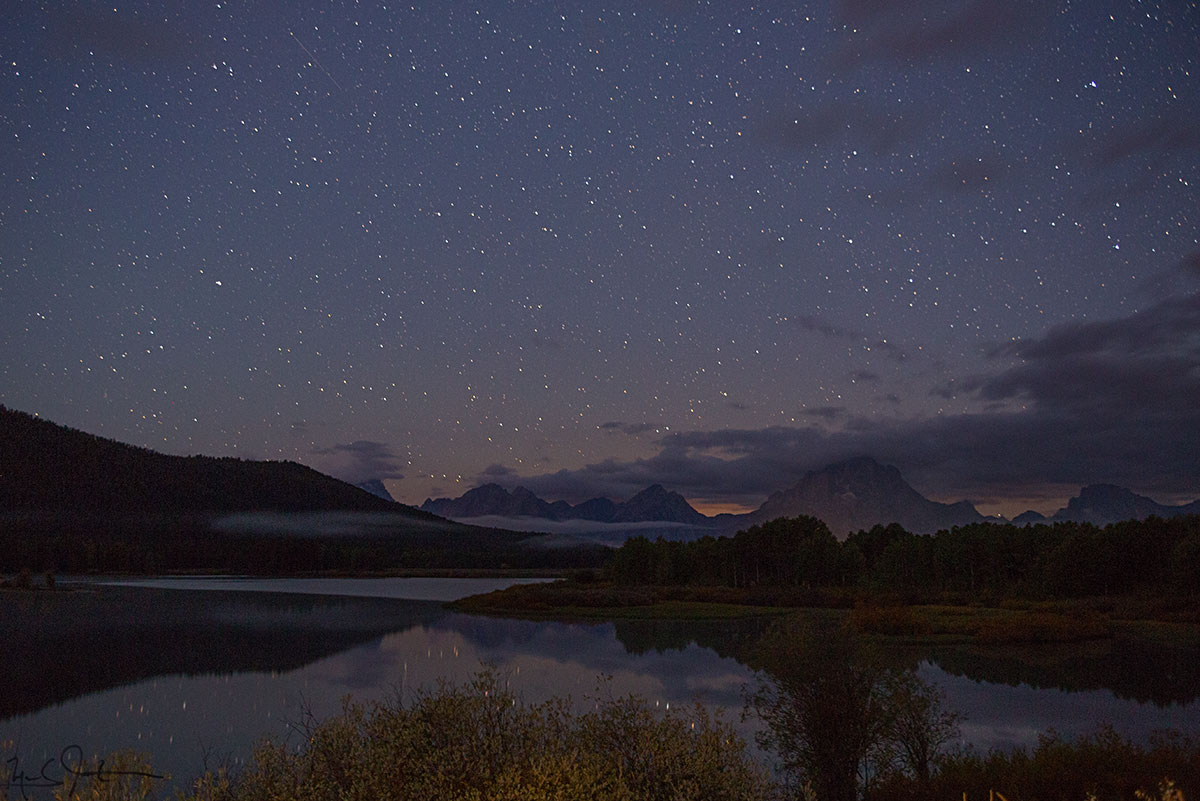
Oxbow Bend at 5:00 AM. Lots of stars . . .
Heading north from Jackson Hole into Yellowstone National Park:

The headwaters area at the southern end of Yellowstone National Park.

Rainbow at Kepler Cascades.

Old Faithful geyser.
And, continuing further north to Glacier National Park:
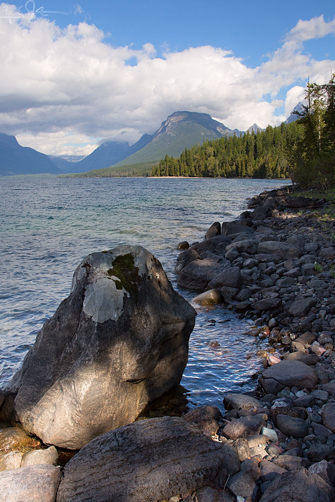
Along the shore of Lake McDonald, Glacier National Park.

Lichens.


Nymphalis antiopa, common name "Mourning Cloak".


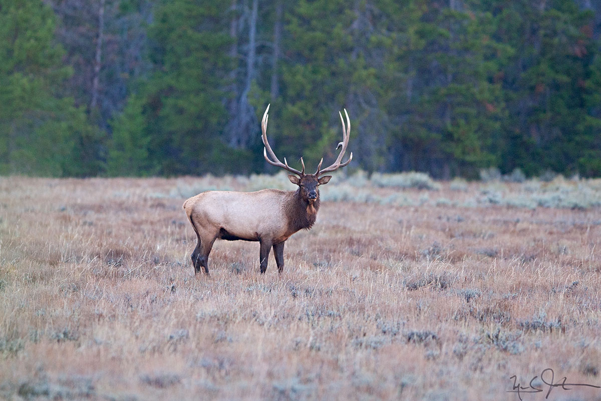
A bull elk checks me out. 30 yards away out the right side of the frame - his harem of 20 females and their youngsters.

The eastern face of the Teton range from the Snake River overlook.
Brief time-lapse of the Teton range under a near full moon [behind the camera].
Anybody who has been watching the news has seen how four or more straight days of rain being pumped into the Front Range of the Rockies has caused severe flooding and damage, with major impact to my town of Lyons.

A 180-degree panoramic view of Rt 66, the only thoroughfare out of Lyons to the east. The left side of the image is eastbound towards Longmont, the right side is westbound into Lyons, with Steamboat Mountain on the horizon. At center, the raging St. Vrain River continues to chew on the south margin of the road.

A vehicle lays stranded on the 5th Ave. bridge as the south fork of the St. Vrain River rushes just below street level. Further up the S. St. Vrain Canyon, Rt. 7 was washed out in multiple places, blocking access into the mountains and Estes Park.
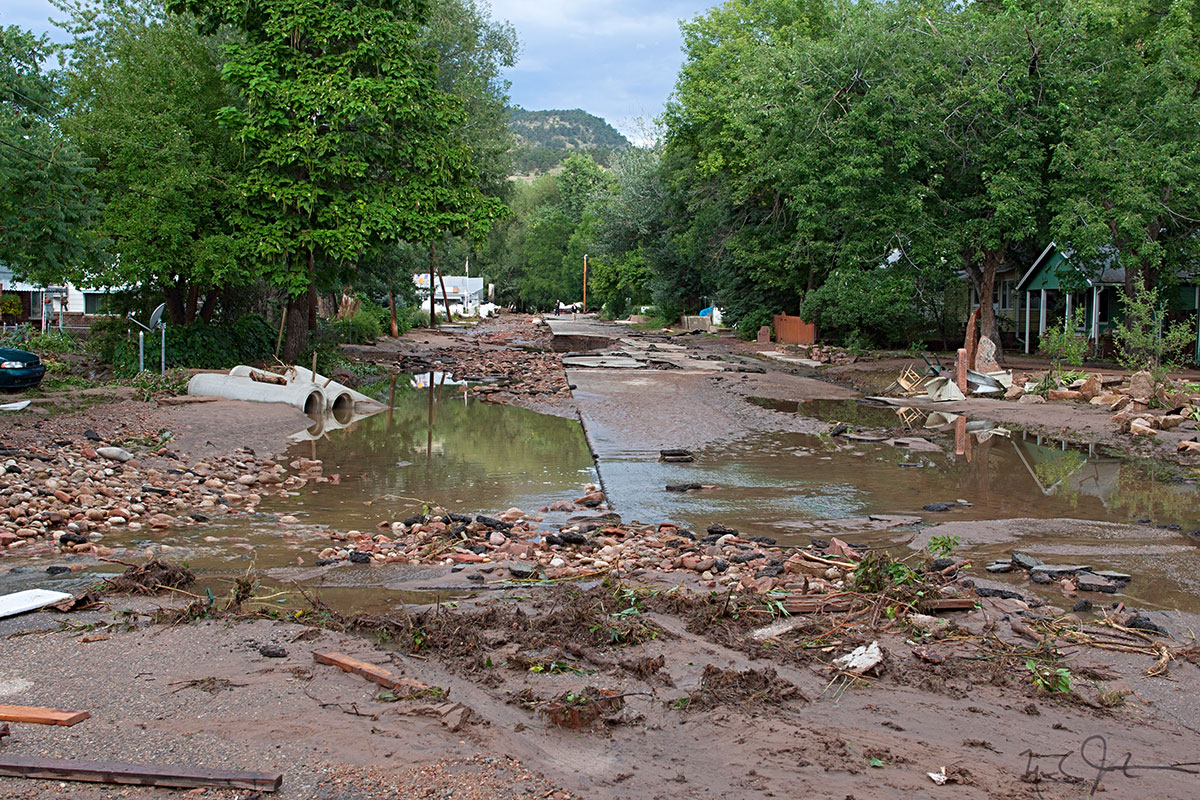
Many low-lying neighborhoods were inundated as the St. Vrain River overran its banks and even cut new channels through the town of Lyons, Colorado.
After being trapped in town by the destruction of large chunks of Hwy 36 between Lyons and Estes Park, damage to the bridge on Rt 7 out of Lyons to the west, and severe flooding on Hwy 66 going east, residents of Lyons were asked to leave on Saturday 14 Sept.

Residents trapped in Lyons by road washouts and floods get the word from the Sheriff's department and City Administration..
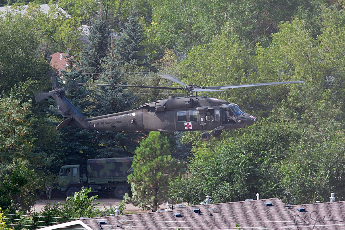
A Blackhawk helicopter sets down on Main St.
I was planning to start a vacation today anyway, so I just left a couple of days early.
I don't know if I will be able to go home to Lyons when my vacation ends, but in the meantime, enjoy a few photos from somewhere besides Colorado.
By the way, based on Facebook's most recent update to their Terms of Use, which basically allows them to use anything - photos, personal info, etc. - you put on Facebook or do on Facebook - for their own commercial gain or any other purpose whatsoever, I am not going to be posting any images there. I may just post a note that there is something new to see here.
Thanks to everyone who expressed concern about my well-being during the last several days, and thanks for all of the kind words and positive feedback about my photography and this site.
Time-lapse video of the Teton Mountain range illuminated by the morning sun. From Oxbow Bend.
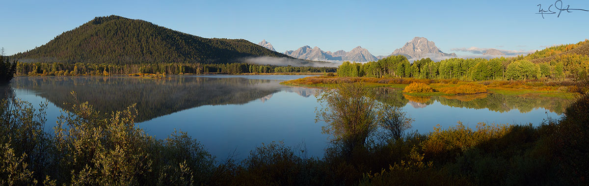
A wider panoramic view from near the same spot.

